Natural resources
Tibet's land holds minerals, fast-falling rivers, sun, wind, grassland, forests and medicinal plants. For centuries Tibetans used them with restraint, and many mountains, lakes and springs are held sacred. Under the occupation, decisions about these resources are taken by Chinese authorities and Chinese companies, and the Central Tibetan Administration and Tibetan communities say the benefits flow out of Tibet while the damage stays. This chapter describes only places where a resource has been documented. A mineral being present is not the same as a deposit that can be mined at a profit: we call figures 'reserves' only when the source does, and mark estimates as estimates.
Documented places
Only places the text names, at town, lake or mine level; shown on the map.
- Zabuye salt lake: Lithium
- Lakkor Tso: Lithium
- Qarhan salt lake: Lithium
- Dartsedo (Ch. Kangding): Lithium
- Nyagchu (Ch. Yajiang): Lithium
- Jomda (Yulong mine): Copper
- Meldro Gungkar (Gyama and Qulong): Copper
- Gyalthang (Pulang mine): Copper
- Sangchu (Ch. Xiahe), Amchok: Gold
- Meldro Gungkar (Gyama): Gold
- Chusum (Luobusa): Chromite
- Zabuye salt lake: Borax, salt and potash
- Zangmu dam: Hydropower and dams
- Metok (Ch. Medog): Hydropower and dams
- Derge (Kamtok dam): Hydropower and dams
- Lianghekou dam: Hydropower and dams
- Yamdrok Tso: Hydropower and dams
- Talatan, Gonghe: Solar and wind power
- Longyangxia dam: Solar and wind power
- Dzoge wetlands: Glaciers, lakes and fresh water
- Nyingtri: Forests and logging
- Chamdo: Forests and logging
- Karze (Ch. Ganzi): Forests and logging
- Ngaba (Ch. Aba): Forests and logging
- Dechen (Ch. Diqing): Forests and logging
- Lhoka: Forests and logging
- Nagchu: Yartsa gunbu (caterpillar fungus)
Rivers flowing to Asia
- Yarlung Tsangpo (Brahmaputra)
- Senge Khabab (Indus)
- Langchen Khabab (Sutlej)
- Mapcha Khabab (Karnali)
- Drichu (Yangtze)
- Machu (Yellow River)
- Dzachu (Mekong)
- Gyalmo Ngulchu (Salween)
- Phungchu (Arun)
- Kyichu (Lhasa River)
- Nyagchu (Yalong)
- Zayul Chu (Lohit)
Minerals
Lithium
Lithium, used in batteries for electric vehicles, is found in Tibet both in the brine of salt lakes and in hard-rock pegmatite. Chinese and foreign demand for batteries has turned these deposits into some of the most sought-after in China.
Where
Salt lakes of the Changtang and Ngari, including Zabuye and Lakkor Tso in the so-called TAR; salt lakes of the Tsaidam basin in Amdo (today in Qinghai), such as Qarhan; and pegmatite at Jiajika near Dartsedo (Ch. Kangding) and in Nyagchu (Ch. Yajiang) county in Karze prefecture, Kham.
Extraction
Tibet Mining began a second phase at Zabuye in 2024, with industry reports giving a capacity of 9,600 tonnes a year of battery-grade lithium carbonate. Zijin Mining's Lakkor Tso project in Gerze county, Ngari, started production in March 2025. In January 2024 Chinese authorities announced a lithium find of nearly a million tonnes in Nyagchu county, reported by the Tibet Policy Institute.
Impacts on Tibetans and the environment
On 4 May 2016 dead fish filled the Lichu river in Minyak Lhagang, Dartsedo county, after waste from the Ronda lithium mine reached it; hundreds of Tibetans protested and the mine was temporarily halted, according to the International Campaign for Tibet. Salt-lake extraction uses large volumes of brine and water in a dry landscape grazed by nomads.
- 1.8 million tonnes Proven reserves claimed for Zabuye salt lake (estimate) – Company figure reported by Yicai Global; the unit (lithium or lithium carbonate) is not stated clearly.
- 2.09 million tonnes Proven and probable reserves at Lakkor Tso (estimate) – Lithium carbonate equivalent, as reported by Mining Weekly from the operator.
- about 1 million tonnes Lithium resources announced in Nyagchu (Ch. Yajiang) county, 2024 (estimate) – A resource announced by Chinese authorities, not a proven reserve.
- 4.6 million tonnes Lithium reserves for all of China, 2026 (estimate) – USGS figure for the whole People's Republic of China; it is not broken down by Tibetan area.
Copper
Tibet holds some of the largest copper deposits under Chinese control, often together with gold, silver and molybdenum. Large open-pit mines have been opened in Kham and close to Lhasa.
Where
Yulong in Jomda (Ch. Jiangda) county, Chamdo; Gyama (Ch. Jiama) and Qulong (Ch. Julong) in Meldro Gungkar (Ch. Maizhokunggar) county near Lhasa; Pulang in Dechen (Ch. Diqing) prefecture, Kham.
Extraction
The Tibet Policy Institute reports 2022 output of about 116,000 tonnes of copper at Yulong, 98,000 tonnes at Pulang and 88,000 tonnes at Qulong. Zijin Mining received approval to more than double processing at Qulong to 350,000 tonnes of ore a day, which would make it the largest single copper mine in China.
Impacts on Tibetans and the environment
On 29 March 2013 a landslide at the Gyama mine buried 83 workers, two of them Tibetan. The CTA's Environment and Development Desk called the disaster man-made rather than natural and reported that waste dumped into the Gyama Shingchu river had killed cattle; it reports that villagers who protested in 2009 were wounded by police.
- 6.5 million tonnes Proven copper reserves at Yulong (estimate) – Reported in 2005 as China's largest proven copper reserve.
- 30-40 million tonnes Copper on the whole plateau, according to the China Geological Survey (estimate) – An estimate by Zhang Hongtao of the China Geological Survey, as reported by the Tibet Policy Institute.
- 83 Workers buried at the Gyama mine, March 2013
Gold
Gold has been panned from Tibetan rivers for centuries, but large-scale and open-pit gold mining under the occupation has met repeated Tibetan protest, often because it destroys mountains held sacred.
Where
Rivers of Kham and Amdo, as reported by the Tibet Policy Institute; Gong-ngon Lari mountain in Amchok, Sangchu (Ch. Xiahe) county, Kanlho (Ch. Gannan) prefecture; Gyama near Lhasa, where gold is mined with copper.
Extraction
Open-pit mining at Gong-ngon Lari has continued for more than a decade, according to the International Campaign for Tibet.
Impacts on Tibetans and the environment
In November 2012 two Tibetans, Tsering Dhondup and Kunchok Tsering, set themselves on fire and died near the entrance to the gold mine at Gong-ngon Lari. In 2016 police beat and detained Tibetans protesting at the same mine, Radio Free Asia reported. In 2013 thousands of Tibetans in Driru protested against mining at the sacred Naglha Dzambha mountain.
Chromite
Chromite, the ore of chromium used in stainless steel, is scarce in China, which makes Tibet's deposits strategically important to Beijing.
Where
Luobusa in Chusum (Ch. Qusum) county, Lhoka, in the Yarlung Tsangpo suture zone. The Tibet Policy Institute also lists chromite among the minerals of the Tsaidam basin in Amdo.
Extraction
Geologists (Zhou and colleagues, 1996) describe Luobusa as the largest known chromite deposit in China, with reserves of several million tonnes of ore.
Impacts on Tibetans and the environment
No independent reporting was found on how chromite mining at Luobusa affects local Tibetans or the Yarlung Tsangpo; this is a gap V-TAG will fill when evidence is published.
Lead, zinc, iron and other metals
Chinese geological surveys report large amounts of lead, zinc and iron ore on the plateau, as well as tungsten, bauxite and rare earths. Most of these are announced resources rather than working mines.
Where
Across the plateau, according to announcements by the China Geological Survey reported by the Tibet Policy Institute; specific deposits are rarely named in public sources, so V-TAG does not place these metals on the map.
Extraction
The Tibet Policy Institute lists about 126 identified types of minerals in Tibet, including bauxite, chromite, copper, gold, iron and silver. The estimates below come from the China Geological Survey, which announced them as finds that would greatly raise China's reserves.
Impacts on Tibetans and the environment
The Tibet Policy Institute links mining to land loss, pollution of rivers and protests at sacred sites, and notes that Tibetans have no say over which mountains are opened up.
- 40 million tonnes Lead and zinc on the plateau, according to the China Geological Survey (estimate) – Estimate attributed to Zhang Hongtao of the China Geological Survey, as reported by the Tibet Policy Institute.
- billions of tonnes Iron ore on the plateau, according to the China Geological Survey (estimate) – Same estimate; no proven reserve is given.
Borax, salt and potash
Tibetan nomads have long collected salt and borax from the dry lakes of the Changtang and traded them south across the Himalaya. Today the same salt lakes are mined industrially for potash, borax and lithium.
Where
Salt lakes of the Changtang, including Jang Tsala Karpo in Nagchu named by the Tibet Policy Institute; Zabuye salt lake in Ngari; the Tsaidam basin in Amdo.
Extraction
Industry reports say the second phase at Zabuye is designed to produce about 156,000 tonnes of potassium chloride a year alongside lithium, and the Tibet Policy Institute reports borax mining in Nagchu.
Impacts on Tibetans and the environment
Industrial salt-lake mining competes with nomads for water and pasture in one of the driest parts of the plateau.
Water
Glaciers, lakes and fresh water
Tibet's ice, snow, lakes and wetlands are its greatest resource and Asia's too. They feed the rivers that water South, Southeast and East Asia.
Where
Glaciers of the Himalaya, Nyenchen Tanglha, Tanggula and Kunlun; lakes across the Changtang and in Amdo; the Dzoge wetlands and the source areas of the Machu and Drichu.
Extraction
Water is taken through dams and diversions, and the Dzoge wetlands were drained in the 1970s for pasture.
Impacts on Tibetans and the environment
Glaciers are shrinking, permafrost is thawing and lakes are expanding over pastures. Because the headwaters are controlled by Chinese authorities, downstream countries such as India and Bangladesh have raised concerns about how dams upstream will change their rivers.
- more than 45,000 Glaciers on the plateau and surrounding mountains (estimate) – CTA figure for the wider Third Pole region, covering about 105,000 square kilometres.
- about 1.3 billion People who depend directly on Tibet's rivers, according to the CTA (estimate) – ICIMOD gives about 1.65 billion people downstream of the wider Hindu Kush Himalaya.
- about 52% Share of Dzoge's original 4,600 square kilometres of surface peat turned to grassland (estimate)
Energy
Hydropower and dams
Tibet's rivers drop thousands of metres from the plateau to the plains, which Chinese authorities see as a vast source of electricity. Dams have been built on the Machu, Drichu, Nyagchu, Dzachu and Yarlung Tsangpo, and more are planned.
Where
The Yarlung Tsangpo (Zangmu, completed in 2015, and the lower-reaches project at Metok, Ch. Medog); the Drichu (the Kamtok dam in Derge); the Nyagchu (Lianghekou in Karze prefecture); Yamdrok Tso; and many dams on the upper Machu and Dzachu.
Extraction
Chinese authorities approved the Yarlung Tsangpo lower-reaches project in December 2024 and began construction in July 2025. Chinese state figures say it will produce 300 billion kilowatt-hours a year, about three times the Three Gorges Dam.
Impacts on Tibetans and the environment
Dams flood villages, farmland, monasteries and sacred mountains. In February 2024 hundreds of Tibetans were detained in Derge after protesting against the Kamtok dam, Human Rights Watch reported. About 6,000 people in four counties were to be moved for the Lianghekou dam. India and Bangladesh have raised concerns about river flows below the Metok project, and Tibetan and international groups, including in a statement to the UN Human Rights Council, have warned of displacement and damage to a fragile, earthquake-prone gorge.
- 60 GW Planned capacity of the lower Yarlung Tsangpo project (estimate) – Chinese official figure as reported internationally.
- 1.2 trillion yuan Expected cost of the lower Yarlung Tsangpo project (estimate) – Chinese official figure; earlier reports gave 'more than 1 trillion yuan'.
- about 6,000 People to be relocated for the Lianghekou dam on the Nyagchu (estimate) – As reported in 2017.
- 510 MW Capacity of the Zangmu dam, the first on the Yarlung Tsangpo (2015)
Solar and wind power
Strong sunlight and wind on the plateau are being turned into electricity on a vast scale, much of it in Tibetan areas of Qinghai.
Where
The best documented site is Talatan in Gonghe county, Tsolho (Ch. Hainan) prefecture, Amdo, beside the Longyangxia dam on the Machu.
Extraction
NASA's Earth Observatory showed the Longyangxia solar park at 850 megawatts in 2017. The surrounding Talatan park has since grown to tens of gigawatts and is described as the largest solar park in the world.
Impacts on Tibetans and the environment
The land at Talatan was traditionally grazed by Tibetan herders. Chinese state media present the park as greening the land and raising herders' incomes through 'photovoltaic sheep'; independent information on how herders were consulted or compensated is not available.
- 850 MW Longyangxia solar park, 2017
- 21 GW Installed solar capacity at Talatan, March 2026 (estimate) – As reported by Wikipedia from industry sources; not independently verified.
Ecological
Grasslands
The grasslands are the base of Tibetan nomadic life and of the wildlife of the plateau. Their turf also protects the soil and holds large amounts of carbon.
Where
Most of the plateau, from the Changtang steppe in the north-west to the Kobresia meadows of Kham and Amdo.
Extraction
Grassland is 'used' through grazing, but under the occupation it has also been fenced, privatised, converted to cropland and taken for mines, roads and solar parks.
Impacts on Tibetans and the environment
Chinese policies of fencing and settling herders, justified as protecting the grasslands, have been documented by Human Rights Watch as coercive. Scientists dispute that herders caused the degradation: the 2010 review by Richard Harris found the evidence insufficient.
- about 450,000 km² Pastures dominated by Kobresia pygmaea (estimate) – Described by Miehe and colleagues as the world's largest pastoral alpine ecosystem.
Forests and logging
The forests of south-eastern Tibet, in Kongpo, Pemakö, Kham and southern Amdo, are among the richest in Asia. After the invasion they were logged on a massive scale for timber sent to China.
Where
The river gorges of Nyingtri, Chamdo, Karze (Ch. Ganzi), Ngaba (Ch. Aba), Dechen (Ch. Diqing) and Lhoka.
Extraction
After the 1998 Yangtze floods Chinese authorities banned commercial logging in the upper Yangtze catchment, which includes much of Kham and Amdo.
Impacts on Tibetans and the environment
Researcher Daniel Winkler found that forest cover in Karze fell from 29.5 per cent to 14 per cent between the mid-1950s and mid-1980s. The loss of forest increased erosion and flooding downstream.
- 221,800 → 134,000 km² Tibet's forest area, 1950 to 1985, according to the CTA (estimate) – Another CTA publication gives 25.2 million hectares falling to 13.57 million hectares; the two series differ.
- US$54 billion Value of timber taken from Tibet up to 1985, according to the CTA (estimate) – The CTA attributes this figure to an official Chinese census; no recent data is available.
- 29.5% → 14% Forest cover in Karze (Ch. Ganzi), mid-1950s to mid-1980s (estimate)
Plants and medicine
Yartsa gunbu (caterpillar fungus)
Yartsa gunbu, 'summer grass, winter worm', is a fungus that grows from the bodies of ghost-moth caterpillars in alpine meadows. Prized in Tibetan and Chinese medicine, it has become the most valuable natural product of the plateau.
Where
High alpine meadows of eastern and southern Tibet, especially in Kham, Amdo and Nagchu, close to the snow line and often near permafrost.
Extraction
Tibetan families dig it by hand each spring and sell it to traders. Daniel Winkler has reported that its value rose by about 900 per cent between 1997 and 2008.
Impacts on Tibetans and the environment
It is a lifeline for rural Tibetans, but harvests are falling. Hopping and colleagues found in 2018 that over-harvesting and warming are both reducing the fungus. The IUCN lists it as Vulnerable.
- 40% Share of rural cash income in the so-called TAR from yartsa gunbu (estimate) – Estimate by Daniel Winkler (2008).
Medicinal plants of Sowa Rigpa
Sowa Rigpa, Tibetan medicine, draws on hundreds of plants from the plateau and the Himalaya, among them snow lotus, Rhodiola, spikenard, Fritillaria, blue poppies and juniper.
Where
Alpine meadows, scree and forest edges across Tibet; many species grow only in small areas.
Extraction
Plants are gathered by Tibetan doctors and villagers and, increasingly, collected in bulk for commercial pharmaceutical markets in China.
Impacts on Tibetans and the environment
Law and Salick showed that heavy collection of the snow lotus Saussurea laniceps has made the plants it leaves behind measurably smaller over a century. The IUCN lists spikenard (Nardostachys jatamansi) as Critically Endangered and the Himalayan fritillary as Vulnerable.
Grasslands and herds
Yaks, sheep and the nomads
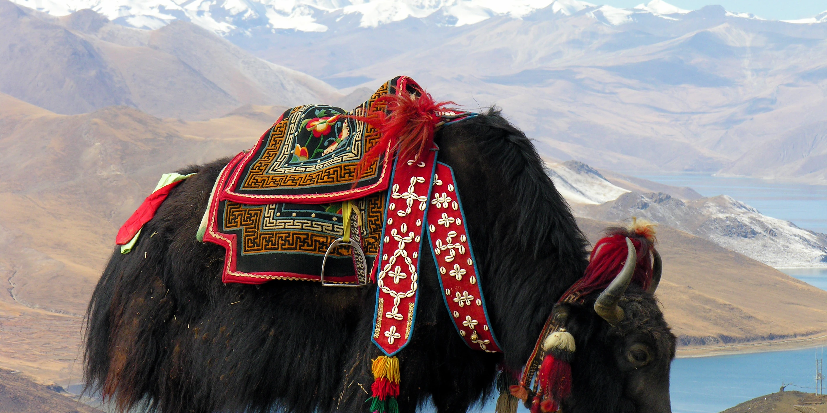
Tibet's herds of yak, sheep and goats have sustained its people for millennia, providing milk, butter, meat, wool, hair for tents and dung for fuel. Nomadic herding is a resource in itself: knowledge of how to move herds across the seasons that protects the grassland.
Where
Across the grasslands, from the Changtang to the meadows of Kham and Amdo.
Extraction
Under the occupation herders have been fenced into fixed plots, told to reduce their herds and moved into settlements under programmes Chinese authorities describe as 'ecological migration', 'comfortable housing' and 'poverty alleviation'.
Impacts on Tibetans and the environment
Human Rights Watch has documented coercive relocation since 2007. Settled herders often lose their livelihood and depend on state support, and the grasslands lose their oldest guardians.
- 2 million Tibetans in the so-called TAR rehoused under 'Comfortable Housing', 2006-2012 – Official figures compiled by Human Rights Watch.
- 300,000 Nomadic herders relocated and settled in Qinghai since the early 2000s – Official figures compiled by Human Rights Watch (2013).
- over 930,000 Rural Tibetans relocated in the so-called TAR, 2000-2025 – Human Rights Watch analysis of official data; 709,000 of them since 2016.